A working volcanic landscape, an hour east of a Redding driveway.
Lassen Volcanic became a national park in 1916 — three years after Lassen Peak itself erupted — and it has stayed alive ever since: steaming fumaroles, boiling mud, lakes that sit on bedrock that was lava in living memory.
What sets the park apart geologically isn't the size, which is modest at 106,452 acres — it's the variety. Plug dome, shield, cinder cone, and stratovolcano are all present here, and there are only a handful of places on Earth where you can stand inside the same boundary and see each one. Lassen Peak (10,457 ft) is the headline plug dome; the Cinder Cone in the park's northeast is its namesake type; the older shields hold up the long ridgelines; and the stratovolcanoes are the remnants of much older mountains that built the foundation.
For relocating families, the practical point isn't the geology. It's that the National Park Service runs the place, the road climbs to 8,500 feet over a single afternoon, and you can be at Manzanita Lake reading interpretive signs while the same kids would have been stuck in I-680 traffic in Walnut Creek. The main park road through the park is closed in winter due to very heavy snowfall and snowpack — it's not unusual for forty feet of snow to accumulate near Lake Helen — so the season that matters is roughly late June through October. Inside that window, the day-trip works.
Photos from a June day at Lassen
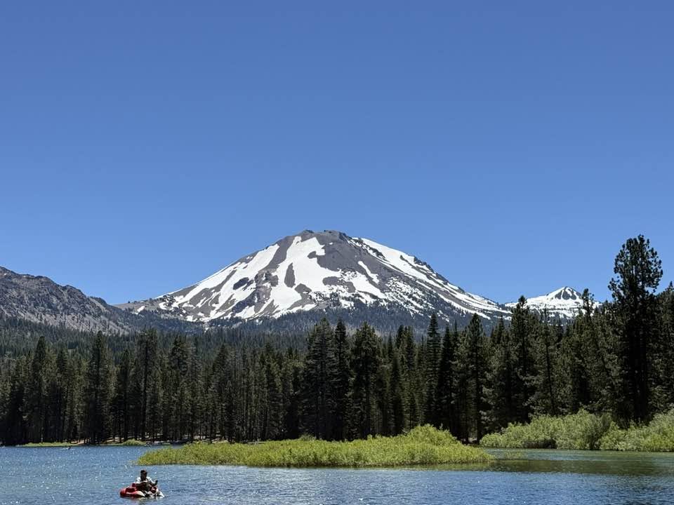
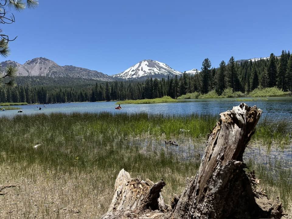
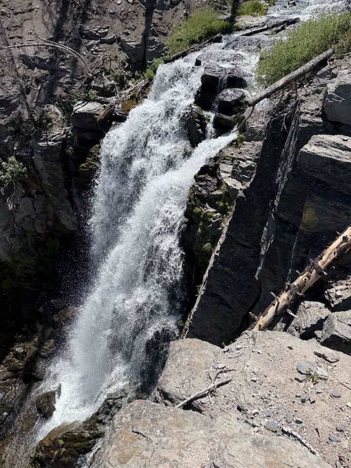
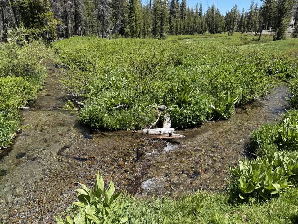
Shot on location by Nathan Cross — Manzanita Lake beneath Lassen Peak at the north entrance, then Kings Creek Falls and the Kings Creek meadow running on early-summer snowmelt.
What's out there
- Manzanita Lake — north entrance, easy loop
- Kohm Yah-mah-nee Visitor Center — south entrance
- Sulphur Works — roadside hydrothermal pull-off
- Bumpass Hell trailhead — ~3 mi RT to mud pots
- Lake Helen — alpine lake, snow into July
- Lassen Peak — 10,457 ft plug dome summit
A full Lassen Saturday, from a Redding driveway.
North-to-south through the park — the order that matters because of where Bumpass Hell falls on the road and when the parking lot fills up.
Manzanita Lake (north entrance)
Highway 44 east drops you at the Loomis Plaza entrance. Pay the fee, do the 1.5-mile lake loop while it's cool, and let the kids watch trout from the bank. The lake is just inside the park, so the elevation gain comes later.
Devastated Area & Sulphur Works
The road gains 3,000 feet on its way south. Stop at the Devastated Area boardwalk (interpretive plaques from the 1915 eruption) and Sulphur Works pull-off, where the hydrothermal gases announce themselves before you've parked.
Bumpass Hell hike
A roughly 3-mile round trip on a moderate trail. The basin is the largest hydrothermal area in the park: mud pots, fumaroles, an elevated boardwalk through the steam. Park early — lots fill up by 11 in peak summer.
Lake Helen photo stop
Right off the road at about 8,200 feet, ringed by snow into July most years. Five minutes — but it's the photograph everyone takes home and the answer to "what does the alpine look like up here."
…and you're back in a Shingletown or East Redding driveway
That's the part that sells the move: this wasn't a vacation. It was a Saturday, and the national park was an hour of road. See homes on the eastern approach →
When to go
Late June through October
The main road through the park closes for winter snow — it's not unusual for forty feet of snow to accumulate near Lake Helen — and reopens in late June or July most years. Inside that window the full Bumpass Hell + Lassen Peak experience is available; outside it, lower-elevation areas like Manzanita Lake and the visitor centers stay accessible.
Two entrances, two stories
North = lakes, south = visitor center
Manzanita Lake in the north is the prettier opener for families: easy loop, ranger station, store. The Kohm Yah-mah-nee Visitor Center at the south entrance is the bigger interpretive building — exhibits, theater, sit-down lunch. For a one-day visit, enter one and exit the other.
Bring a card
The park is cashless
Since 2023 every entrance station takes cards only — no cash at the gate (the gift shops and café still take it). A 7-day vehicle pass is $30 in summer and $10 in winter; annual, senior, and free options are in the fee table below.
Bring layers
8,000 ft means weather flips
It can be 90° in Redding and 60° at Bumpass Hell on the same afternoon — pack a fleece. Snow patches near Lake Helen persist into July, and afternoon thunderstorms over the peaks are normal mid-summer. Sun, wind, and altitude all hit at once.
What it costs to get in
Every vehicle needs one entrance pass — buy it at the gate or in advance on Recreation.gov. One thing to know before you drive out: the park went cashless in 2023, so bring a card.
No cash — cards only
As of April 2023 every entrance station is cashless. Bring a credit or debit card, or buy your pass ahead online. Cash still works at the park's gift shops and café — just not at the entrance gate.
| Entrance pass | Price | What it covers |
|---|---|---|
| Private vehicle — 7 days | $30 summer · $10 winter | Everyone in the vehicle, 7 days |
| Motorcycle — 7 days | $25 summer · $10 winter | Rider + passenger, 7 days |
| Per person — on foot or bike, 7 days | $15 summer · $10 winter | One person, 7 days |
| Lassen Volcanic annual pass | $55 | Lassen + Crater Lake, Whiskeytown & Lava Beds — one year |
| America the Beautiful (interagency) | $80 / year | Every federal recreation site — one year |
| Senior (62+) — annual / lifetime | $20 / $80 | Interagency, all federal sites |
| Military · 4th grader · disability access | Free | Interagency, with eligibility |
Summer rates run April 16–November 30; the $10 winter rate applies December 1–April 15, when the main park road is closed by snow and only the lower areas stay open. Figures are National Park Service rates current as of 2026 — confirm on the official Lassen fees page.
Estimated drive time from every Shasta County area
Straight-line estimates with a road-network adjustment to the Lassen Peak coordinate — useful for comparison, not turn-by-turn. From Redding, Highway 44 east is the fastest route to the north entrance at Manzanita Lake (~50 mi); the south entrance via Highway 36 is closer to 85 miles.
| From | Drive time | Distance |
|---|---|---|
| Redding | ~69 min | 63.5 mi |
| Shasta Lake | ~70 min | 63.9 mi |
| Anderson | ~62 min | 56.4 mi |
| Palo Cedro | ~57 min | 52.4 mi |
| Cottonwood | ~61 min | 55.9 mi |
| Bella Vista | ~56 min | 51.4 mi |
| Lakehead | ~79 min | 72.5 mi |
| Burney | ~42 min | 38.4 mi |
| Round Mountain | ~46 min | 42.5 mi |
| Shingletown | ~39 min | 27.3 mi |
Lassen Volcanic — common questions
How far is Lassen Volcanic National Park from Redding?+
The park's north entrance at Manzanita Lake is about 50 miles east of Redding via Highway 44 — typically a one-hour drive. The south entrance near the Kohm Yah-mah-nee Visitor Center is roughly 85 miles via I-5 south and Highway 36 east, closer to 90 minutes.
Is Lassen Volcanic National Park open year-round?+
Yes, but with seasonal road closures. The park itself stays open, while the main park road through the park is typically closed during winter due to very heavy snowfall and snowpack. The road usually reopens in late June or July; some patches of snow can persist into July near Lake Helen.
What is the entrance fee, and does Lassen take cash?+
Every vehicle needs one pass, and entrance stations have been cashless since 2023 — bring a credit or debit card, or buy ahead on Recreation.gov. A standard 7-day pass is $30 per private vehicle in summer (April 16 through November 30) and $10 in winter, $25 for a motorcycle, or $15 per person on foot or bike. A $55 Lassen Volcanic annual pass also covers Crater Lake, Whiskeytown NRA, and Lava Beds National Monument; the $80 America the Beautiful interagency pass covers all federal sites, with a $20 senior annual option and free passes for military members, fourth graders, and visitors with a permanent disability.
What's the iconic hike?+
Bumpass Hell is the most-visited destination — a roughly 3-mile round trip on a moderate trail to one of the largest hydrothermal areas in the park, with boiling mud pots, fumaroles, and a boardwalk through the basin. Lassen Peak itself (10,457 ft) is a separate, more strenuous hike of about 5 miles round trip from the trailhead.
Homes on the Lassen approach
Shingletown sits at about 3,500 ft on the southern Highway 44 route — closer to the south entrance and the cinder cone country than anywhere else in the county. Buyers who plan their weekends around Lassen look hard here.