The bridge that put Redding on the architecture map.
Santiago Calatrava designed exactly one bridge in the United States, and it's here — a 700-foot cantilever spar cable-stayed crossing of the Sacramento River that opened on July 4, 2004.
The mechanics are unusual on purpose. A single 217-foot steel pylon, tilted to a 42-degree angle, carries all the cables on one side. The deck never touches the water — the bridge was engineered that way to protect salmon spawning gravel on the riverbed below. And the pylon itself works as the gnomon of a working sundial: stand on the bridge near the summer solstice and you can watch the shadow move about a foot per minute, which is essentially the Earth's rotation made visible.
It's free, it's open day and night, and it sits at the seam of the city's outdoor identity. The south end lands inside Turtle Bay Exploration Park — museum, gardens, animal exhibits — and the north end drops you onto the Sacramento River Trail, a paved loop that runs about 17 miles past Diestelhorst Landing and back. Buyers from out of town show up to look at houses and end up walking the bridge instead. We let them.
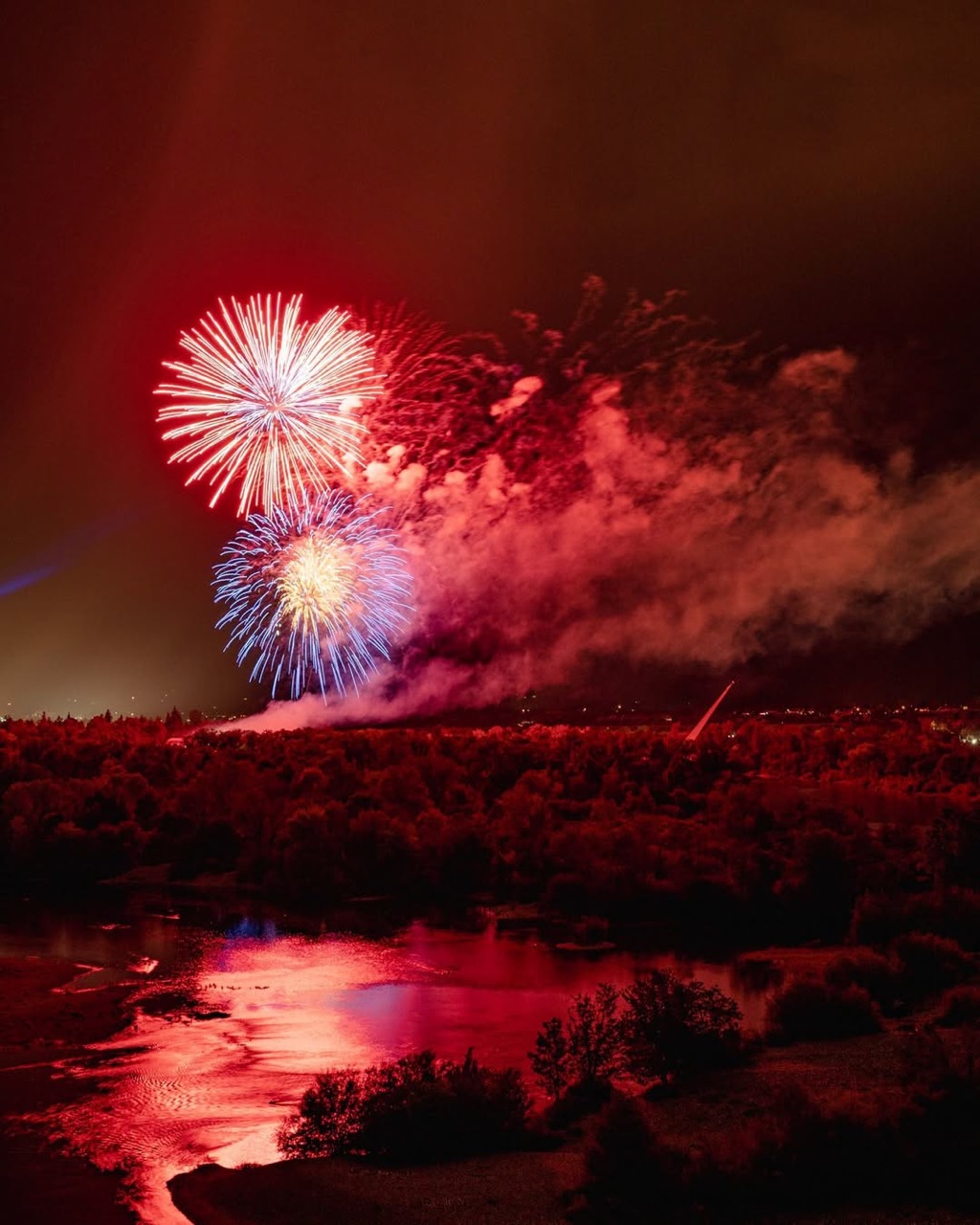
Fourth of July on the river
Redding runs its fireworks show over the Sacramento River right beside the bridge. If you move here, this is your July.
What's out there
- Sundial Bridge — Calatrava's 2004 pedestrian span
- Turtle Bay Exploration Park — museum & gardens
- McConnell Arboretum & Botanical Gardens — 200 acres
- Diestelhorst Bridge — 1915 trail crossing
- Sacramento River Trail — paved riverside loop
A first Sundial Saturday, on foot from a Redding driveway.
A built-from-the-bridge loop that uses the trail, the gardens, and the museum — useful for a relocating family deciding whether the river side of town earns the move.
Turtle Bay parking lot
Park free at 844 Sundial Bridge Drive on the south side. Coffee and water are the morning's only logistics; the bridge itself costs nothing.
Cross the Sundial Bridge
700 feet of glass deck and a 217-foot tilted pylon. Stop at the midpoint to read the date marks for the gnomon shadow — at solstice it lines up exactly, the rest of the year it's a few degrees off and you can tell.
North bank to Diestelhorst Bridge
About 1.5 miles west on the paved Sacramento River Trail you reach the 1915 Diestelhorst Bridge, retired from car traffic and dedicated to walkers and bikes. The "city without the city" feel — water on one side, oak woodland on the other.
McConnell Arboretum & Botanical Gardens
Two hundred acres of native plant gardens on the south side. Self-guided, peaceful, and a good answer to "what do you do in Redding in 100-degree summer" — the irrigated micro-climate makes it cooler than the parking lot you came from.
…and you're back in a Lake Redding driveway
That's the part that sells the move: the icon is the daily walk, not the weekend trip. See homes within walking distance of the bridge →
Best time
Golden hour and the solstices
Sunset over the deck is the photograph everyone takes; the solstices (June 21, December 21) are when the gnomon shadow tracks its design lines. Summer mornings beat summer afternoons by a wide margin — Redding gets hot.
Bridge vs. park
The bridge is free; Turtle Bay isn't
You can walk the Sundial Bridge and the river trails for nothing. Turtle Bay Exploration Park's museum, animal exhibits, and indoor programs have separate admission — easy to skip if you're just there for the bridge.
Where to park
Turtle Bay south lot, then walk
844 Sundial Bridge Drive is the obvious lot — free, paved, signed. The north side has more limited parking near the trailhead. With kids and strollers, default south side.
Stay on the trail
17 paved miles, both banks
The Sacramento River Trail loops about 17 miles via the Sundial and Ribbon bridges. Paved, gentle, runnable, and the closest thing Redding has to a single neighborhood-connecting amenity.
Estimated drive time from every Shasta County area
Straight-line estimates with a road-network adjustment — useful for comparison, not turn-by-turn. From most of Redding, the bridge is a 5–10 minute drive depending on which side of the river you're on.
| From | Drive time | Distance |
|---|---|---|
| Redding | ~5 min | 1.3 mi |
| Shasta Lake | ~18 min | 8.4 mi |
| Anderson | ~20 min | 14.3 mi |
| Palo Cedro | ~14 min | 10.0 mi |
| Cottonwood | ~29 min | 20.2 mi |
| Bella Vista | ~19 min | 13.3 mi |
| Lakehead | ~41 min | 28.4 mi |
| Burney | ~63 min | 57.3 mi |
| Round Mountain | ~39 min | 36.2 mi |
| Shingletown | ~39 min | 35.6 mi |
Sundial Bridge — common questions
Is there a cost to cross the Sundial Bridge?+
No. The Sundial Bridge is a free public pedestrian bridge, open year-round. Turtle Bay Exploration Park, on the south side, has paid admission for its museum and gardens.
Who designed the Sundial Bridge?+
The Spanish architect Santiago Calatrava designed the Sundial Bridge. It opened on July 4, 2004 and is a cantilever spar cable-stayed bridge — the support tower carries cables on one side only and functions as a sundial gnomon.
Where do I park to walk the Sundial Bridge?+
The main parking area is on the south side at Turtle Bay Exploration Park (844 Sundial Bridge Drive). Sundial Bridge parking is free to walk the bridge; Turtle Bay's museum and gardens have separate admission.
Is the Sundial Bridge wheelchair accessible?+
Yes. The bridge has a continuous accessible deck with a gentle slope and is wheelchair- and stroller-friendly. The Sacramento River Trail on both sides is paved.
Homes within walking distance of the bridge
Lake Redding, Lake Redding Estates, and the Garden Tract neighborhoods sit on the north bank of the Sacramento River, with quiet access to the trail and the bridge itself.