An English chalk stream, accidentally placed in Shasta County.
Hat Creek runs 48.7 miles from the eastern slopes of Lassen Peak to Lake Britton, and the lower 3.5 miles of it are the reason fly anglers fly into Redding.
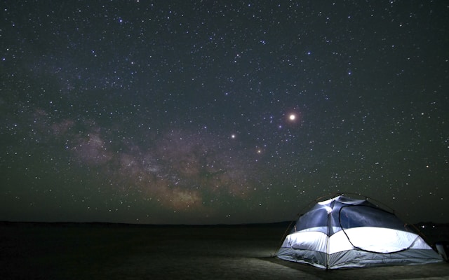
The geology is the story. The headwaters come up out of spring vents at about 6,300 feet on Lassen's east flank; the volcanic basalt holds water like a sponge, releases it cold and steady, and the result is a stream whose temperature, flow, and chemistry stay closer to a Hampshire chalk stream than a Sierra freestone river. Wild rainbow and brown trout — both naturalized, neither stocked — hold in the riffles below Powerhouse 2 in the section California's Department of Fish and Game designated a Wild Trout Waterway. Twenty-inch fish are documented; the catch-and-release crowd swears by it.
You're not just visiting a fishery, though. The corridor cuts through Lassen National Forest, runs past the small communities of Hat Creek and Old Station (the latter sitting right at the Hwy 44/89 junction near the north entrance to Lassen Volcanic National Park), and feeds into Lake Britton — the reservoir that also holds Burney Falls and the Pit River. So the relocation framing is straightforward: a serious wild-trout stream, a national park, and a national-natural-landmark waterfall are all reachable on the same eastern-Hwy-44 drive from a Redding driveway.
What's out there
- Hat Creek (wild trout section) — Cassel area
- Hat Creek Campground — USFS at Old Station
- Old Station — Hwy 44/89 junction community
- Lake Britton — Hat Creek + Pit River confluence
- Burney Falls — adjacent attraction, 30 min north
A Hat Creek + Lake Britton Saturday, from a Redding driveway.
East on 44, breakfast in Old Station, the wild trout section at Cassel, lunch at Burney Falls. A full day, one tank of gas.
Drive east
About 75 minutes on Hwy 44 east, through Shingletown and Manzanita Lake territory before the road bends north at Old Station. The early hour matters — the wild trout section reads best in cool morning light.
Breakfast at the Hwy 44/89 junction
Old Station is the small community at the top of Hat Creek — a couple of breakfast spots, a gas station, and the start of the corridor that runs north. Fill up here; the next reliable fuel is back in Burney or Redding.
Wild trout section near Cassel
The 3.5-mile wild trout section below Powerhouse 2 is what fly anglers come for. Day-use access from Hwy 89, on-stream parking. CDFW wild-trout regulations apply — barbless hooks, single hooks, catch-and-release in the designated stretch.
McArthur-Burney Falls Memorial State Park
114-foot waterfall on Burney Creek, fed by springs that keep flow near-constant year-round. Teddy Roosevelt called it the "Eighth Wonder of the World," and the National Natural Landmark designation is from 1954. Day-use fee at the state park. Pack lunch.
…and you're back in a Burney or Round Mountain driveway
Hwy 299 west is the shorter return route from Burney back to Redding. That's the part that sells the move: the wild trout corridor and the waterfall are both Saturday-drive distance. See homes near the eastern corridor →
Best season
Year-round, with peaks
Spring-fed flow keeps Hat Creek fishable in all four seasons. Hatch matters: caddis emergences in May and June, hopper season in late summer, blue-winged olives into fall. Winter access is harder — Hwy 44 can ice; the corridor itself stays open with chains.
Licenses & regs
CDFW required, wild-trout rules
A California fishing license is required (no on-stream day pass — buy from CDFW online or any sporting-goods store). The Wild Trout Waterway stretch below Powerhouse 2 is barbless hooks, single hooks, catch-and-release; the rest of the creek runs under standard CA trout regs. Check current CDFW supplement before fishing.
Where to start
The Cassel access points
If you've never fished Hat Creek before, the public access points along Hwy 89 between Cassel and Powerhouse 2 are the entry. Local fly shops in Burney and Redding have current condition reports and the right local patterns.
It's a fishery and a corridor
Pair with Burney Falls or Lassen
A day on Hat Creek pairs naturally with Burney Falls (30 min north), the north entrance of Lassen Volcanic National Park at Old Station, or Subway Cave lava tubes just north of Old Station. Three real attractions on one 90-mile loop.
Estimated drive time from every Shasta County area
Straight-line estimates with a road-network adjustment to the Hat Creek landmark coordinate (wild trout section) — useful for comparison, not turn-by-turn. From Redding, Highway 44 east is the standard route.
| From | Drive time | Distance |
|---|---|---|
| Redding | ~74 min | 67.9 mi |
| Shasta Lake | ~70 min | 63.8 mi |
| Anderson | ~74 min | 67.8 mi |
| Palo Cedro | ~64 min | 58.8 mi |
| Cottonwood | ~77 min | 70.2 mi |
| Bella Vista | ~58 min | 53.3 mi |
| Lakehead | ~68 min | 62.7 mi |
| Burney | ~18 min | 12.4 mi |
| Round Mountain | ~35 min | 32.0 mi |
| Shingletown | ~47 min | 43.0 mi |
Hat Creek — common questions
How far is Hat Creek from Redding?+
About 67 miles east of Redding via Highway 44, typically a 75-minute drive. Old Station — the small community at the upper end of the creek — sits at the junction of Highways 44 and 89 just outside the north entrance of Lassen Volcanic National Park.
Why is Hat Creek famous for fly fishing?+
Hat Creek's lower 3.5 miles carry the Wild Trout Waterway designation from California's Department of Fish and Game, and the spring-fed flow with a stable temperature produces geology comparable to English chalk streams. Wild rainbow and brown trout reaching 20 inches are documented. A California fishing license and current CDFW wild-trout regulations apply.
Where does Hat Creek begin and end?+
The creek rises in two forks on the eastern slopes of Lassen Peak at about 6,300 feet and flows north for 48.7 miles to Lake Britton, where it joins the Pit River. Most of the corridor sits within Lassen National Forest and Lassen Volcanic National Park.
What else is nearby?+
McArthur-Burney Falls Memorial State Park is about 30 minutes north — a 114-foot waterfall on Burney Creek that empties into the same Lake Britton reservoir Hat Creek does. Subway Cave lava tubes and the north entrance of Lassen Volcanic National Park are also within 10 minutes of Old Station.
Homes on the eastern corridor
Burney and Round Mountain sit on the Hat Creek approach — closer to the wild trout section and Burney Falls than anywhere else in the county, and a different price band than central Redding.